Horn Heath Suffolk. Picture from British Geological Survey website
Breckland sandy heath landscape
Horn Heath, Suffolk

Surface Geology
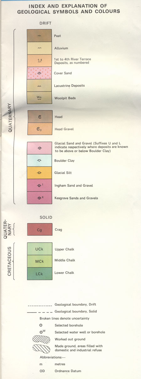
Around Bury St Edmunds
Click images to isolate individual maps

Surface Geology from Inst of Geological Science sheet 189.

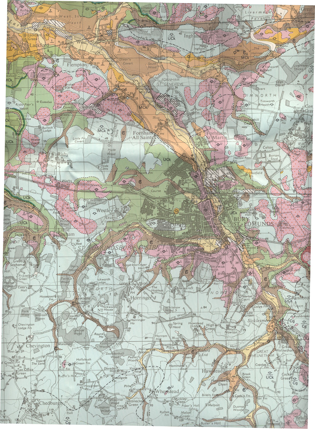
This map shows the geology which directly influences the surface soil and topography around Bury.

Key to Surface Geology from Inst of Geological Science sheet 189.

Source:

Bury St Edmunds - sheet 189 - Solid and Drift edition, 1:50,000
Published by the Institute of Geological Sciences, 1982.
(Now called The British Geological Survey)


Go to Maps homepage Produced 23rd November 2010 Go to Main Home Page