 |
|

|
Maps and Diagrams
Map Page 1 |
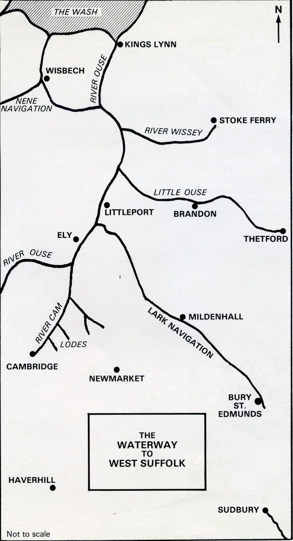 Outline sketch of the main Fenland Rivers by David Weston. |

The Fens in Roman times, showing a new Roman canal changing the location of the River Lark's junction with the Great Ouse. |
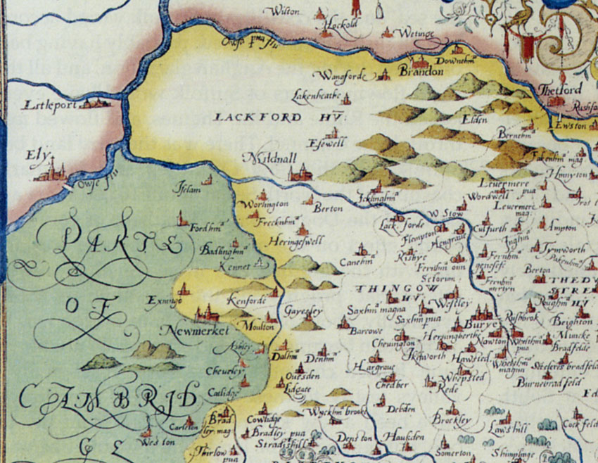 The River Lark as shown on Christopher Saxton's Map of Suffolk. This dates from 1575 and was the first printed map of Suffolk. |
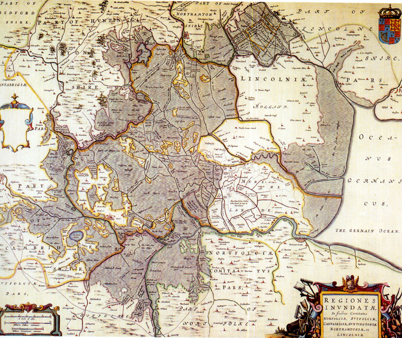 J Bleau's map of the undrained Fens in 1648. The top of the map is West. North is to the right. |
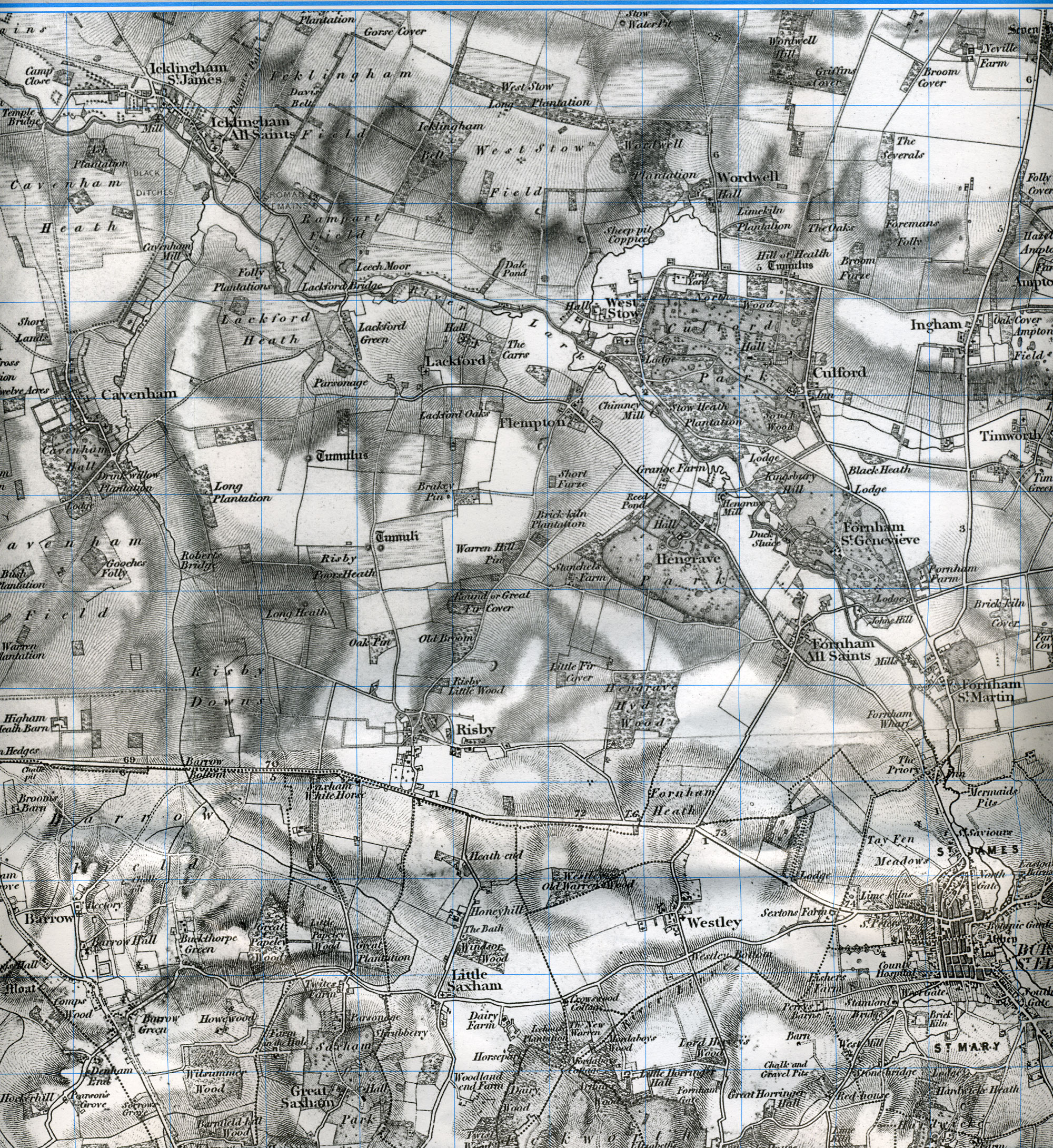
 Lenny's map of 1823 showing the "L" shaped cut from the River Lark to Fornham Wharf. |
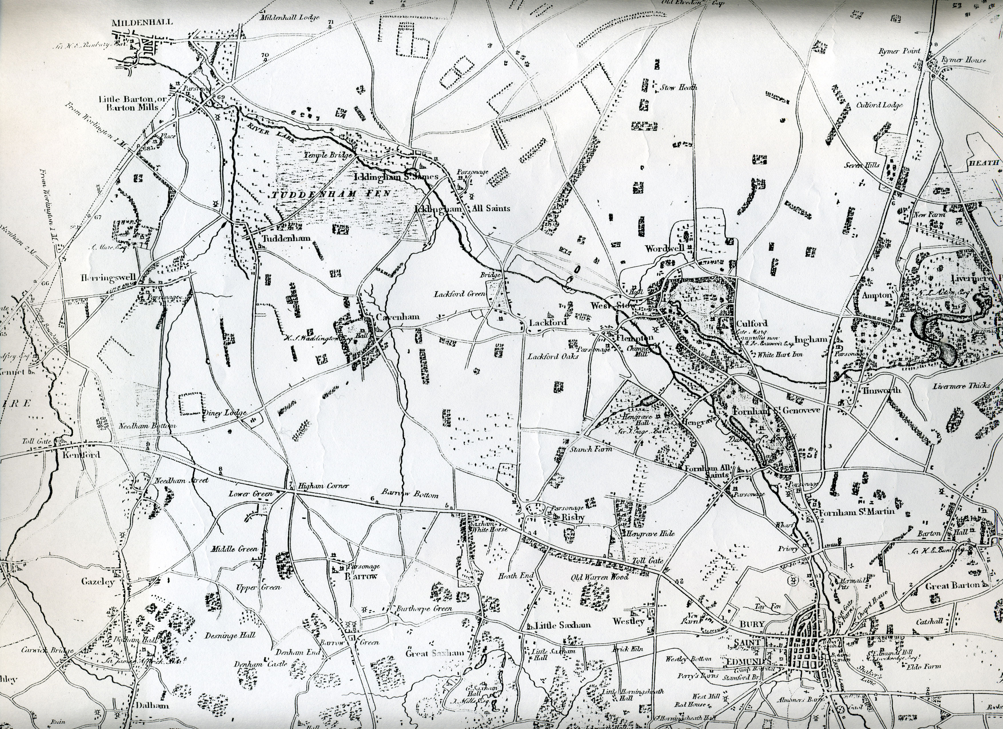 Lenny's map of 1823 showing the River Lark from Bury St Edmunds to Mildenhall. |
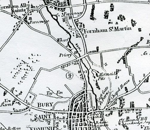
 OS map dated 1837 showing the Fornham Wharf as a single cut. As yet this is unexplained. Unless the OS survey took place before Lenny's survey. |
 OS map of 1955 with minor revisions to 1964, still showing the derelict Cut from the River Lark to Fornham Wharf. |
 Gordon Fowler's map of Fenland Waterways. Originally drawn for the Royal Geographic Society in 1946, this has been redrawn in 1970 to include the Cut-Off Channel of 1961. |
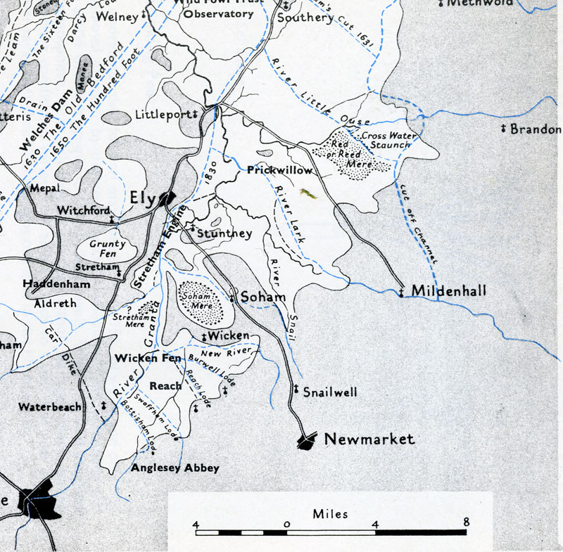 Gordon Fowler's map of Fenland Waterways enlarged to show the River Lark and the Ely section of the Great Ouse. |
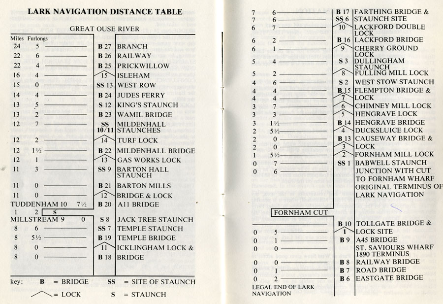 David Weston's Table of Distances along the River Lark, c1980 |
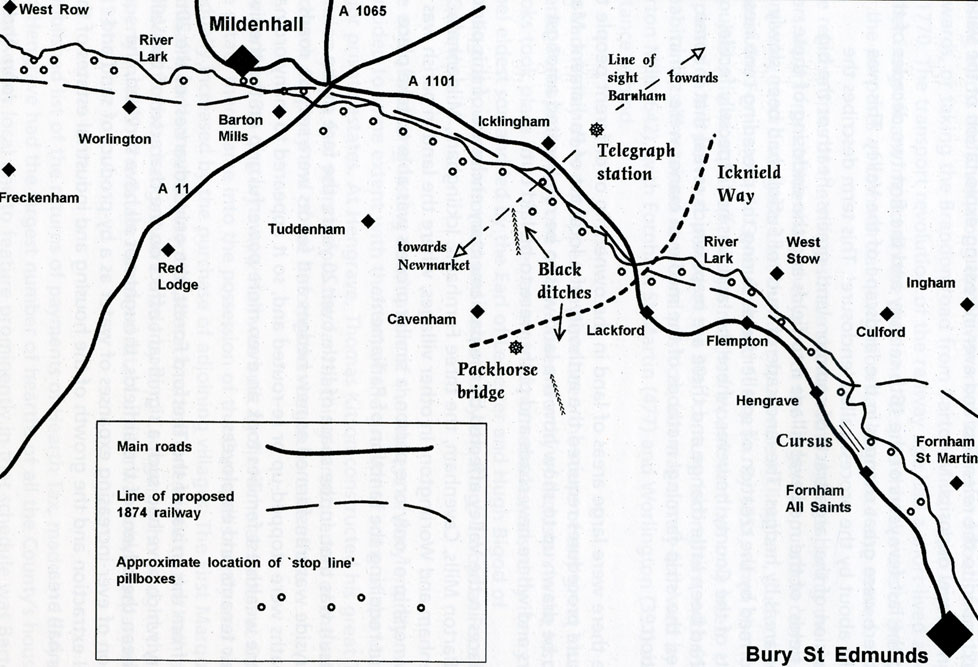 Historic Features of the Lark Valley. Taken from "The Lark Valley" by the Lark Valley Association. |
Page: 1
This is the only River Lark map page at present |
|
| Go to River Lark homepage |
Produced 20th February 2008 Updated 12th March, 2008 | Go to Main Home Page |